U.S. National Park Service Flight 93 National Memorial
June 19, 2016: I continued on US 30 for
another 32 miles East of Latrobe, Pennsylvania until I reached the U.S. National
Park Service Flight 93 Memorial site. I was surprised when I saw a small
road sign indicating it was just 3 miles ahead. Until I saw that small
sign, I had not thought about the location of Shanksville or the Flight 93 crash
site. Up until then, this was just a Sunday drive to see an old US highway
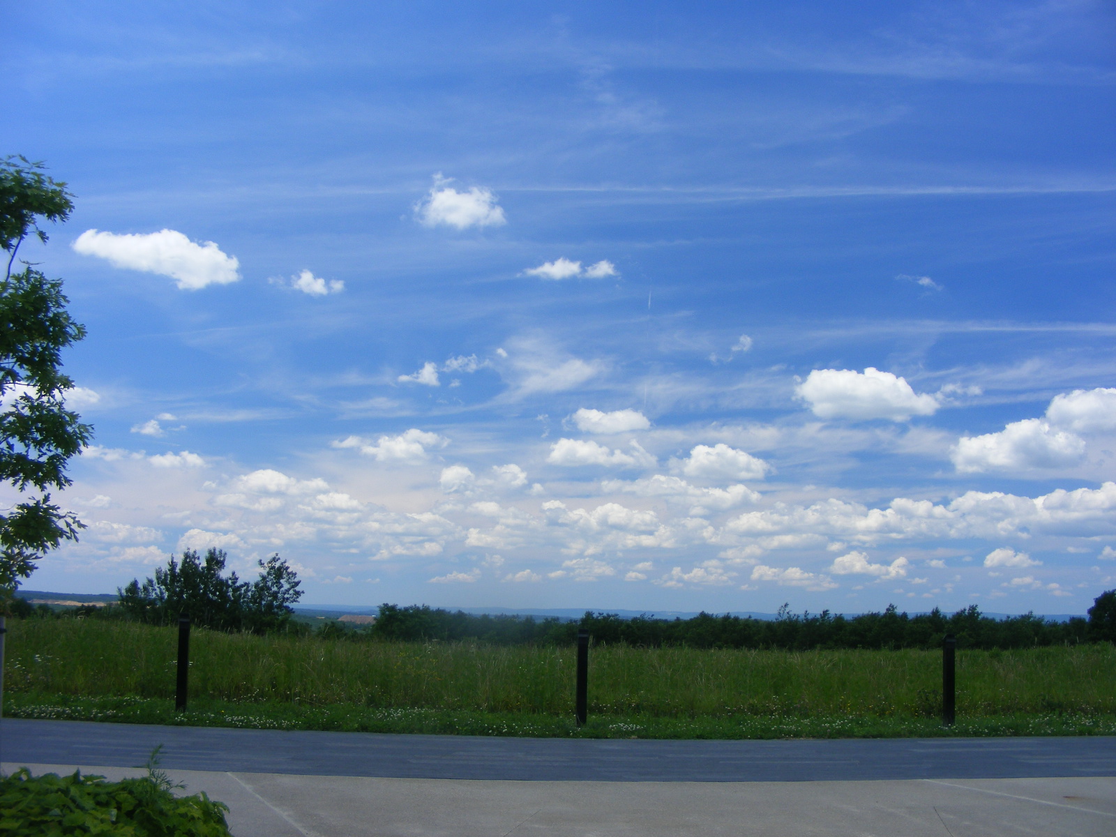
I had never traveled before. The weather on September 11, 2011 looked
a lot like it does on the day of my visit to the memorial. I took
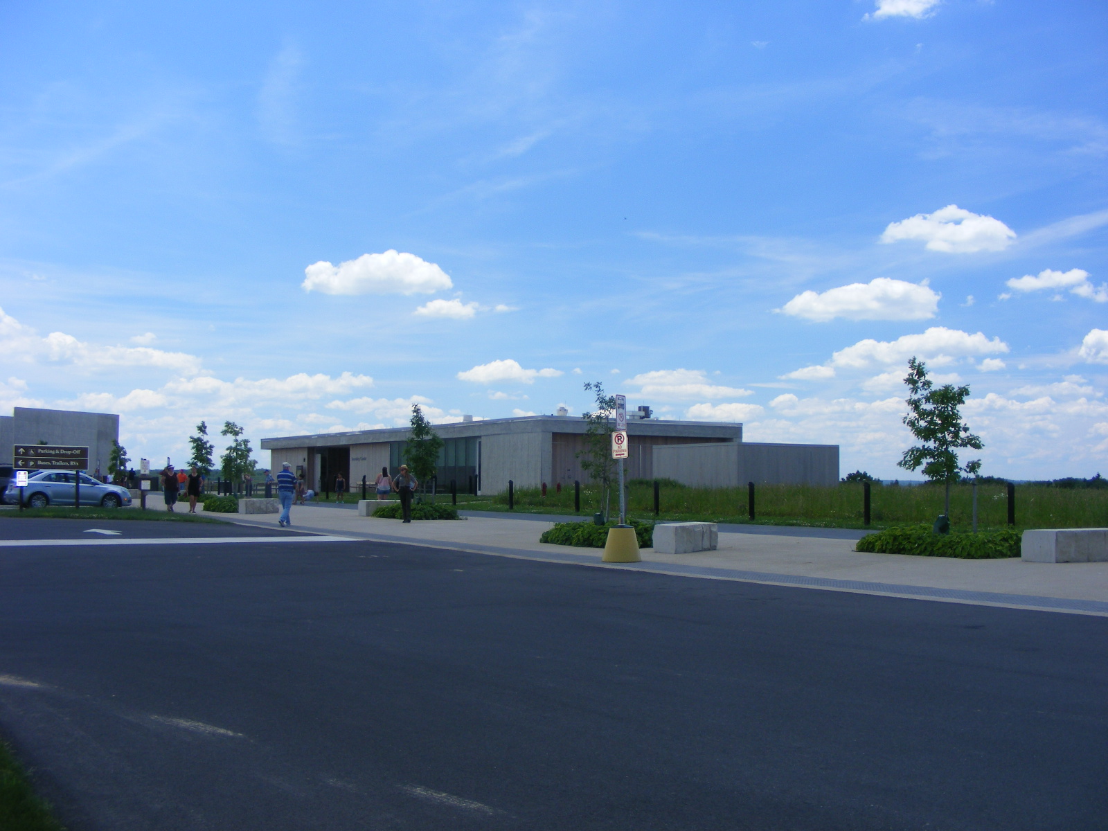
this photo looking West from the main parking lot near the museum building.
The museum building is on the left, most of it not in this photo.
The building in the center of the photo is the learning center with a couple of
meeting rooms. One U.S. National Park Ranger is there to meet and greet
visitors and answer their questions. She is a local who grew up in this county.
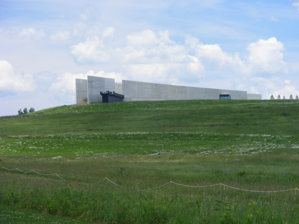
This is the main museum building as seen from the crash site area down the
hill. The building is laid out to match the final flight path of doomed
airliner. The dark area extending from the building is an overlook with a
clear view of the whole area below looking south and west from the hill.
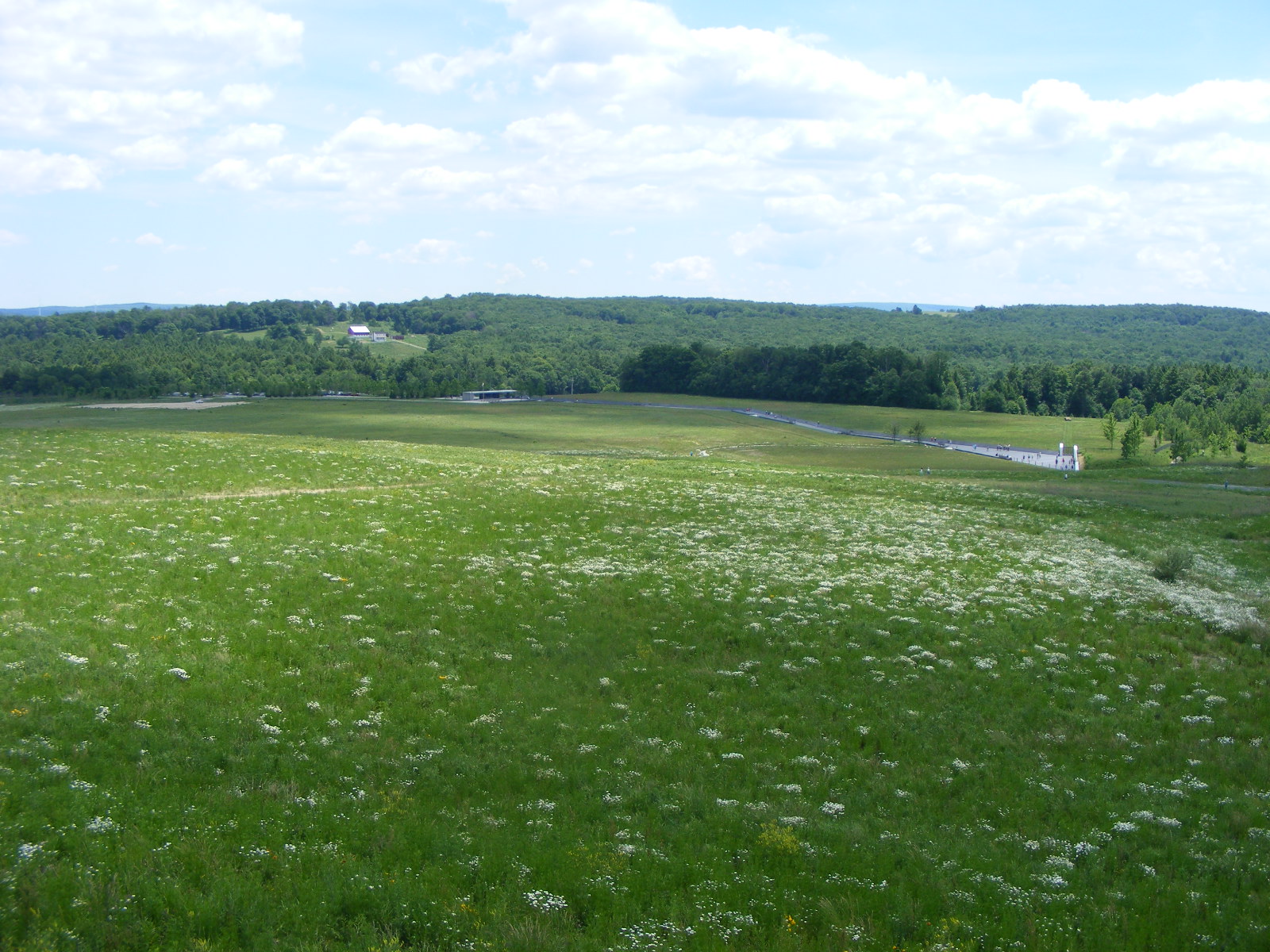
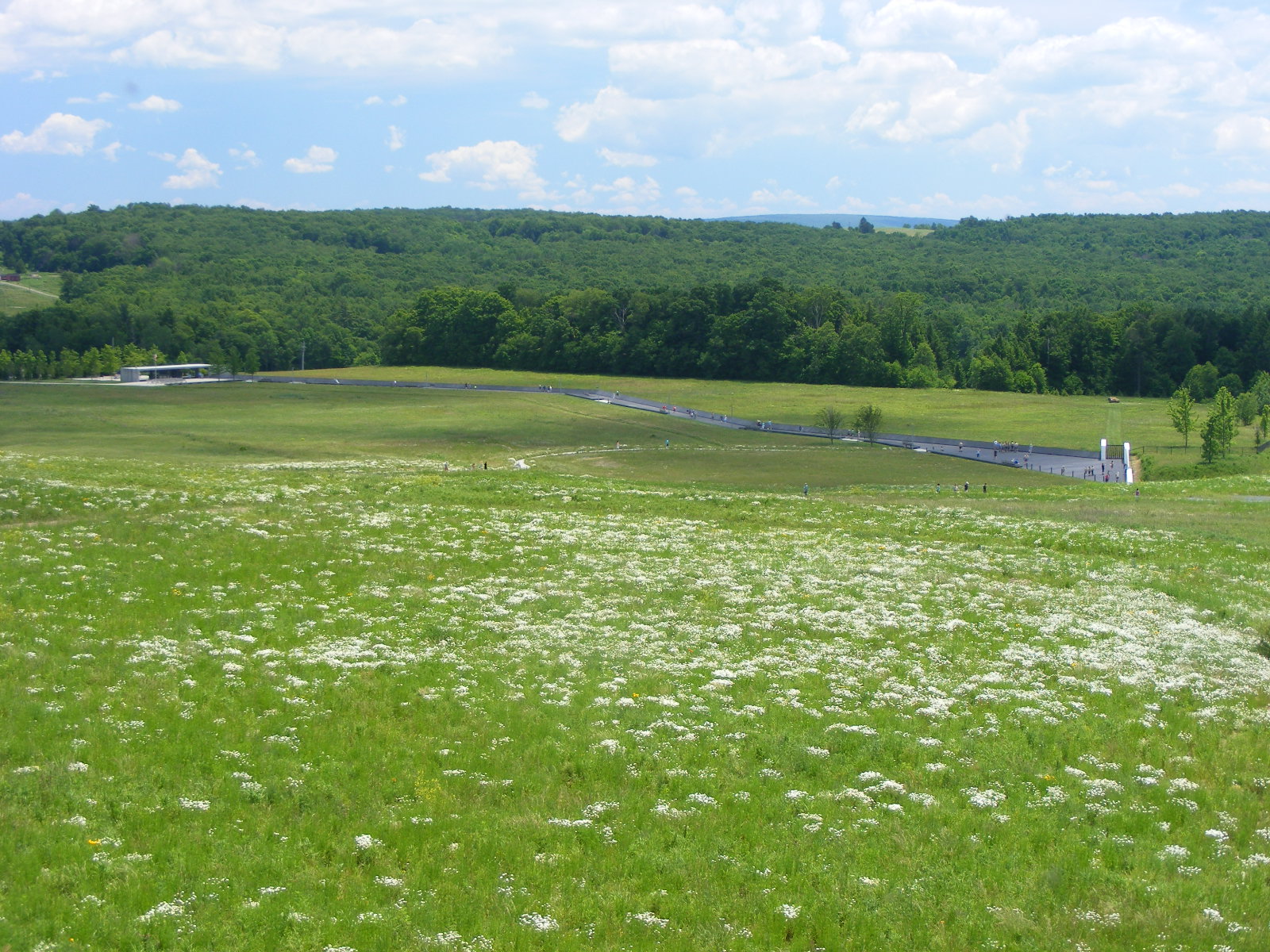
Here is the wide view from the overlook at the museum building on the
hill. I have left this image full size to show the details of the crash
site. Use the slider bar at the bottom of the screen to see all the
details of the following images. A nearby farm is visible on the hill near the
horizon. There is a parking area and an open air amphitheater where park
rangers give presentations about the events of 9-11-2001 that ended here.
A paved walkway extends to the granite memorial wall near the right side of the
photo below. A trail from the museum building leads down to that
area. Cars and busses can drive down to the parking area.
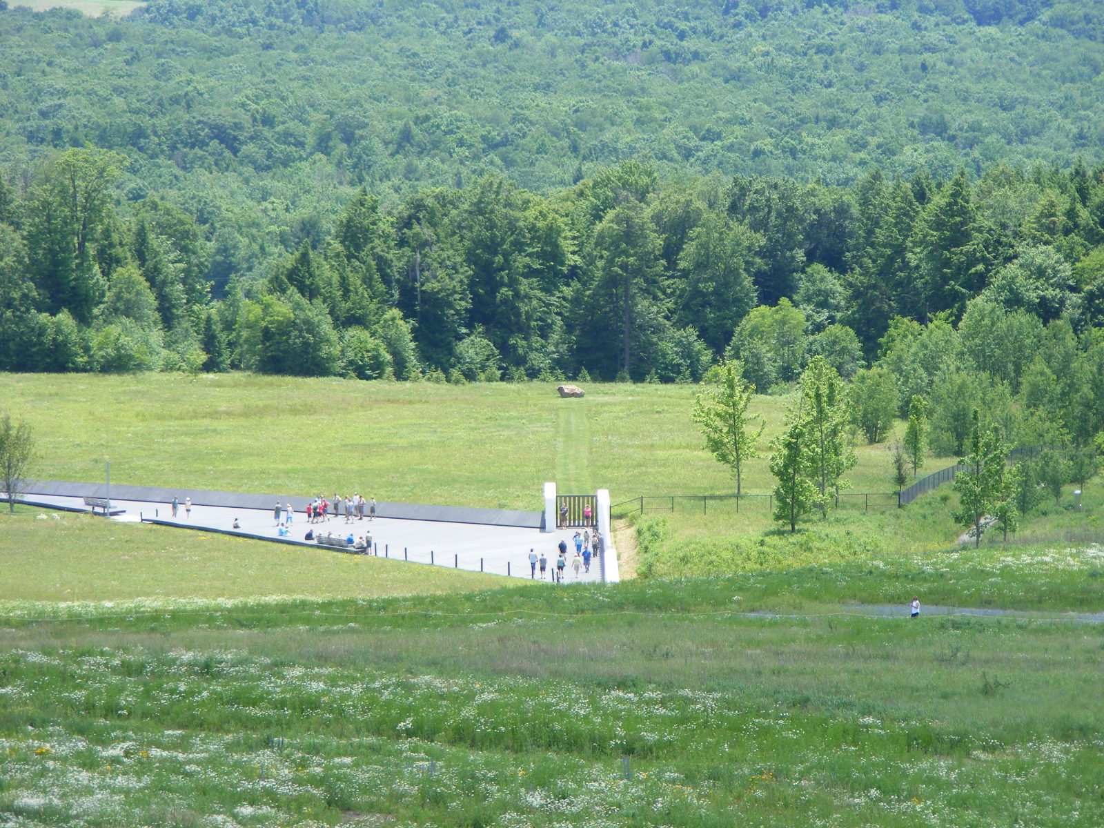
This is a zoomed image showing more detail of the amphitheater, walkway,
granite wall, and a large boulder in the distance marking the final resting
place of the crew and passengers of United Airlines Flight 93. The walking
trail is also visible winding its way down to the crash site. (Use the web
browser bottom slider bar to the left and right to see all of the image.)
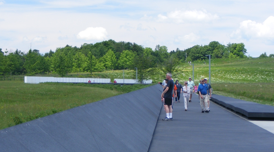
This zoomed shot shows how the hiking trail meets the paved walkway near
the memorial wall. One hiker is visible on the right side of the
image. There is a fence from the memorial wall leading off to the right of
the image. All the grassy area between the wall and trees beyond is a
cemetery. The short grass strip from the wall to the boulder marks the
final flight path.
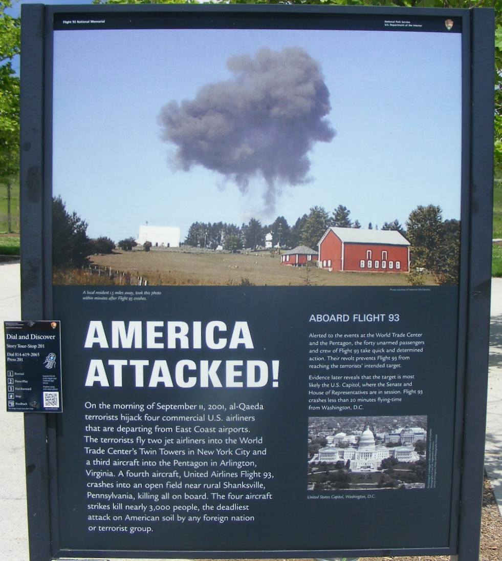
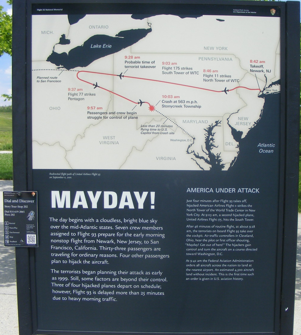
There are a number of information signs when you walk from the parking lot
to the amphitheater. They are shown here in sequence as I encountered them
on way to the memorial wall.
|
Here is the text from the right side of the first sign seen above: ABOARD FLIGHT 93 "Alerted to the events at the World Trade Center and the Pentagon, the forty unarmed passengers and crew of Flight 93 take quick and determined action. Their revolt prevents Flight 93 from reaching the terrorists' intended target." "Evidence later reveals that the target is most likely the U.S. Capitol, where the Senate and House of Representatives are in session. Flight 93 crashes less than 20 minutes flying-time from Washington, D.C." |
Each sign adds more to the story of that tragic day.
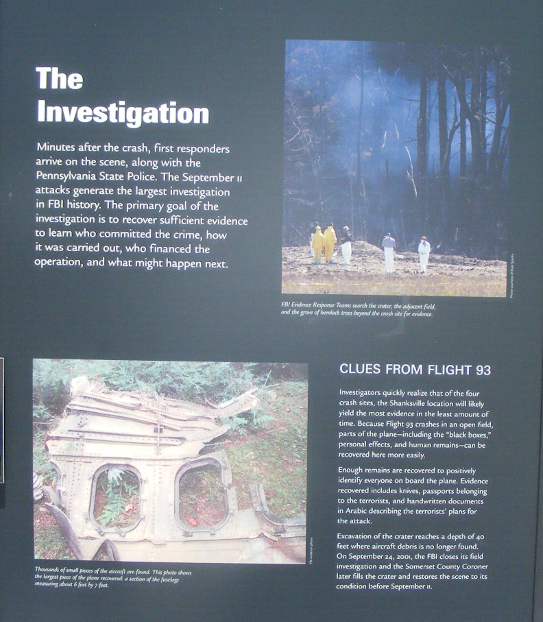
The impact crater of the Boeing 757 is seen below with the first
responders in the background.
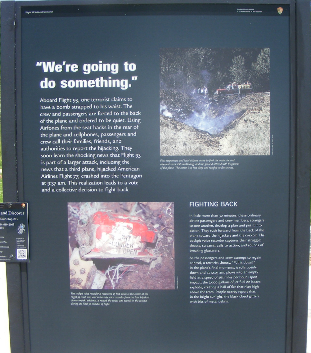
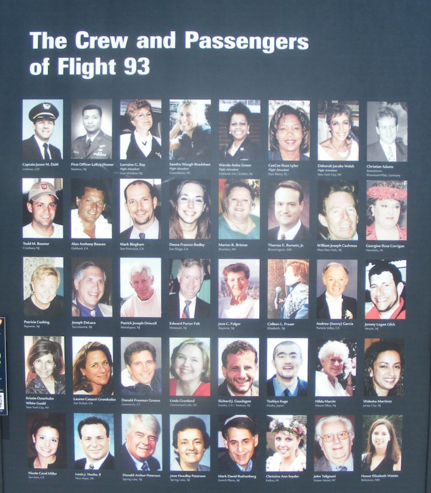
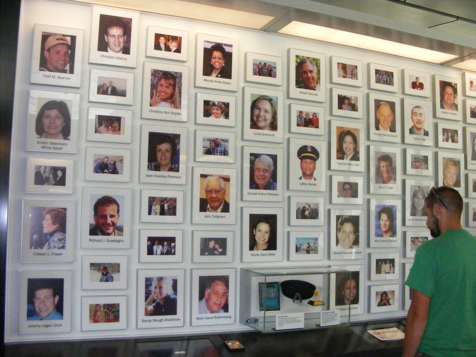
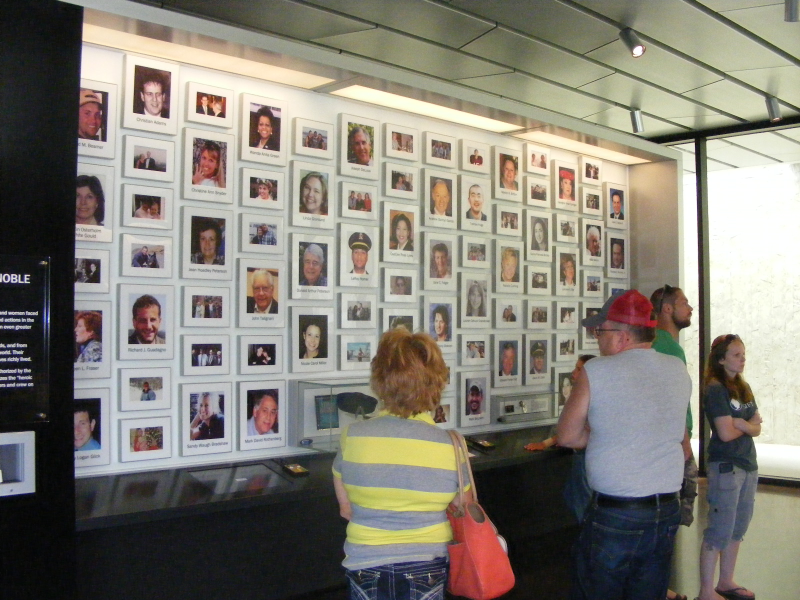
The flight recorders from United Flight 93 seen in the image above were the only ones recovered from the four hijacked aircraft from 9-11-2001. The flight data recorder provided the course and speed of the Boeing 757 that crashed here that day. Wreckage and human remains were found to a depth of 40 feet below ground level. Todd Beamer is seen in the images below in the second row under the captain of Flight 93. Todd was one of the passengers who called his family and was heard to say "Let's Roll" to another passenger as they began their revolt against the hijackers. When I first saw this sign below, I began to feel the emotions I had on that day in 2001. I feel some of that emotion again today as I create this web page.
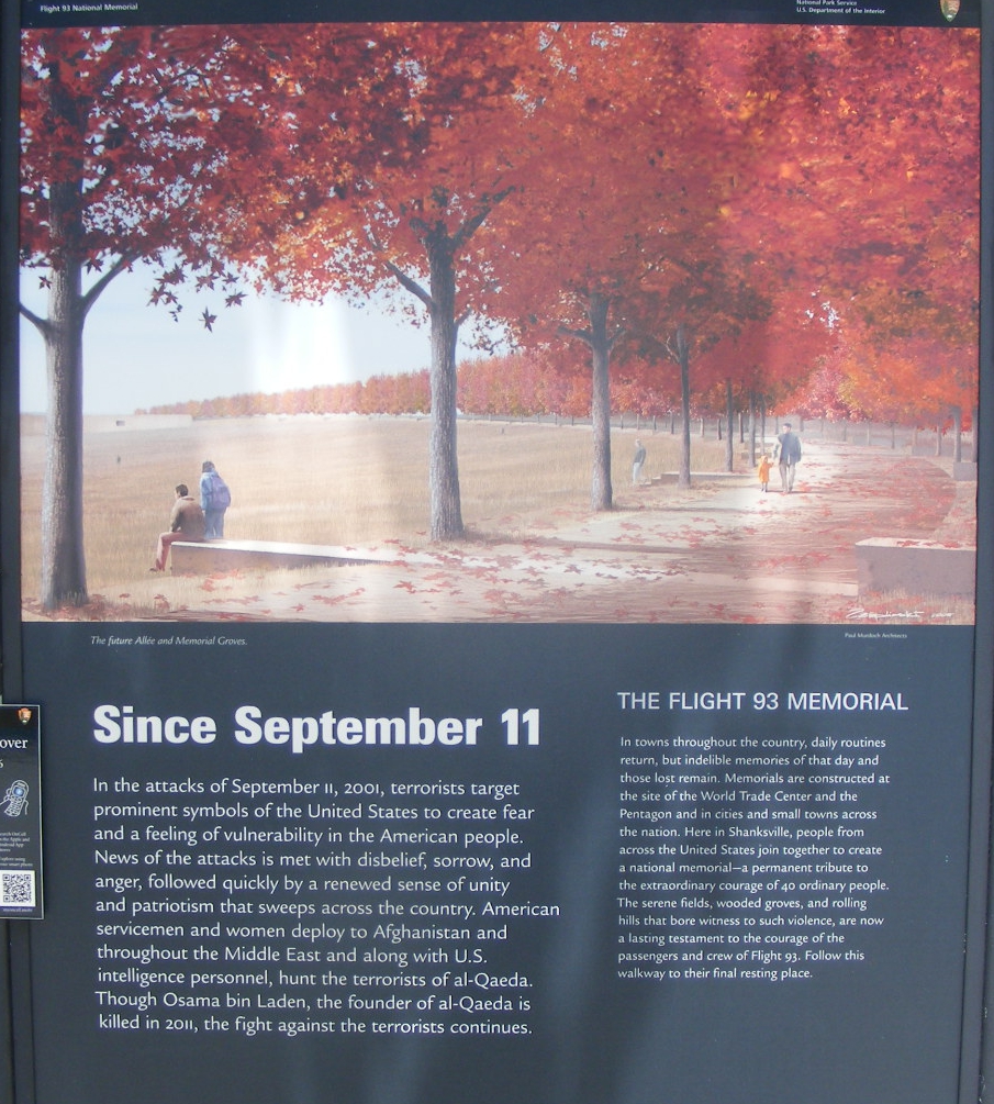
There are 40 groves of trees planted along the road from the museum at the
top of the hill. The trees follow the road going toward the parking lot near the crash
location. You see them here in their bright fall colors. This second
walkway also follows the roadway and the trees.
|
Here is the text from the right side of the sign seen just above: THE FLIGHT 93 MEMORIAL "In towns throughout the country, daily routines return, but indelible memories of that day and those lost remain. Memorials are constructed at the World Trade Center and the Pentagon and in cities and small towns across the nation. Here in Shanksville, people from across the United States join together to create a national memorial -- a permanent tribute to the extraordinary courage of 40 ordinary people. The serene fields, wooded groves, and the rolling hills that bore witness to such violence, are now the lasting testament to the courage of the passengers and crew of Flight 93. Follow this walkway to their final resting place. |
The signs shown above are all between the parking lot and the amphitheater
where Park Rangers give their talks and answer questions about Flight 93.
This is my view of the amphitheater while looking south from the walkway as I
paused heading north toward the memorial wall.
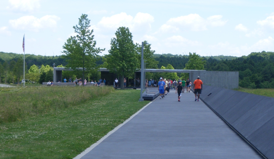
A visitor stops to look West across the green field along the walkway
going North to the wall.
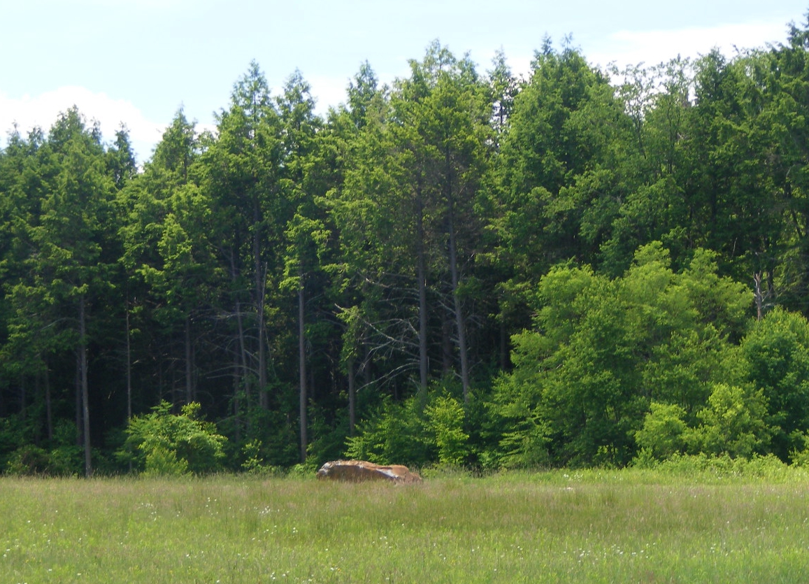
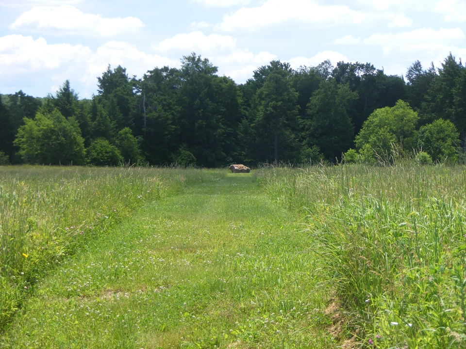
Here is the view from the walkway of the boulder marking the impact site
of the aircraft and the final resting place of the crew and passengers.
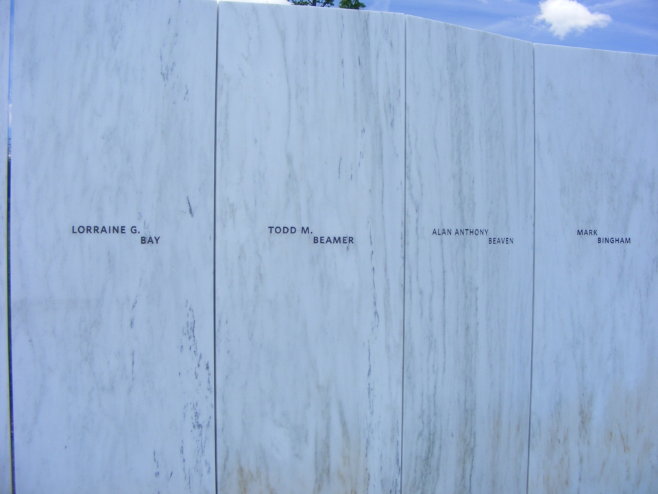
This wall of 40 granite markers lists the names of the passengers and crew
of Flight 93. They are aligned with the flight path of the aircraft before
the crash.
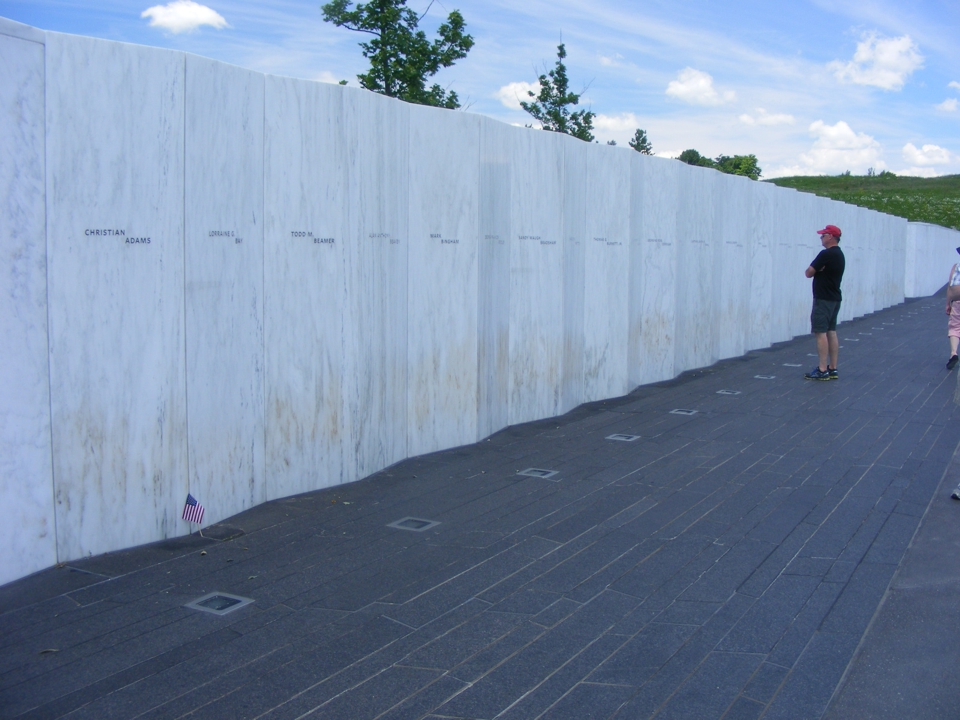
I noticed this marker for Todd Beamer was near the end of the wall closest
to the crash site. The marker positions are sorted by last name.
The Western end of the wall has this wooden gate with space between the
timbers to see the flight path beyond.
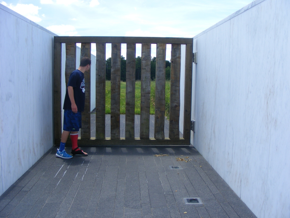
Here is the view through the gate. The grass is kept mowed to make
the boulder more visible from ground level and it marks the final part of the
flight path.

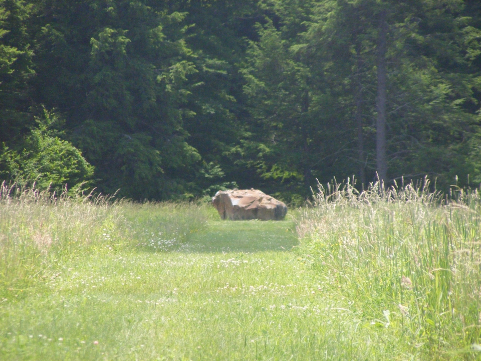
This is my fully-zoomed image of the boulder. It has not been carved
in any way. It is an ordinary boulder serving as a grave marker for
ordinary people who did an extraordinary thing to stop the last of four
terrorist attacks on 9-11-2001.
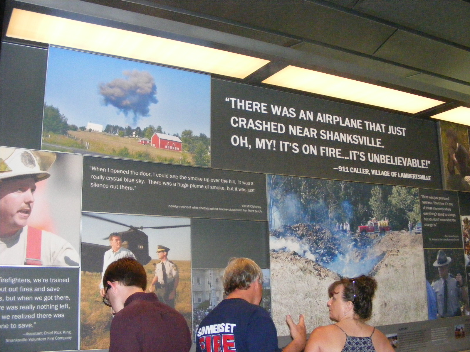
There are a number of exhibit walls at the museum on the hill. I
have again provided the full width of my photos at maximum resolution.
(Use your browser slider bar below.)
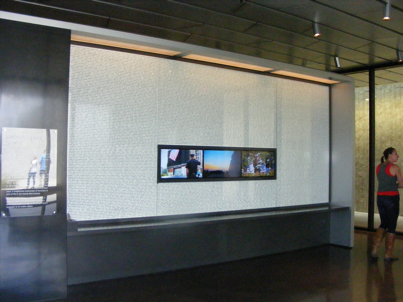
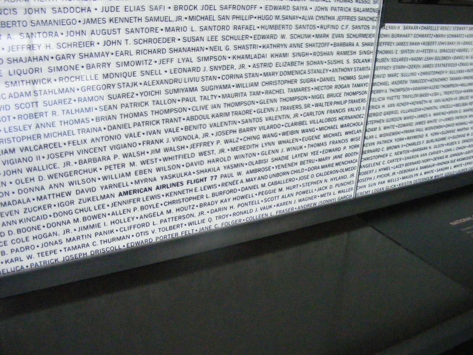
This wall contains the names of all the people killed on 9-11-2001 as a
result of the terrorist attacks.
Each wall in the museum addresses the events of 9-11. There is one
wall with video screens showing the network news footage of that day.
| Return to Other Travels Menu | Return to PAGE 405 | Return to MAIN MENU |