OSHKOSH 2010 -- Saint Louis and the Gateway Arch · · PAGE 5
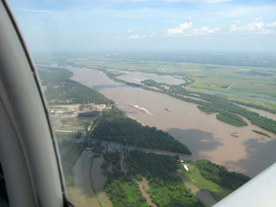
July 24, 2010: The ride to Saint Louis was short
and bumpy since we flew along below the clouds and in the thermals from the ground below.
As we approached the Mississippi River south of Saint Louis, the clouds cleared due
to the effects of the river and the water temperature. I spotted the tug pushing
these barges upstream and had Edward get some photos as we flew past. The flooding
near the river tells of all the recent rain falling into the tributaries north of this
location.
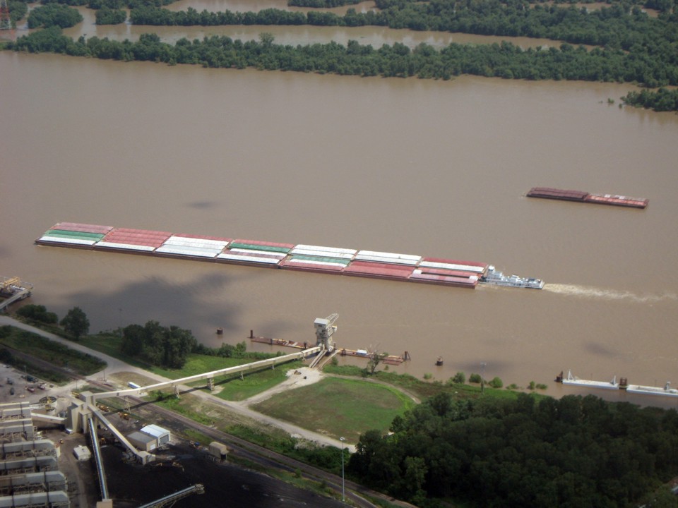
That tug is pushing 35 barges. That is the most number of barges ahead of
one tug boat I have ever counted on the river on any of my flights across the Mississippi
River. The other good thing to see in this photo is the barge loading facilities on
this side of the river at the bottom of the photo. At the bottom right corner of the
picture is a place to moor barges either before or after they are filled here.
We contacted the KCPS control tower at the East Saint Louis Airport.
Since the Arch is inside their class D air space, we had to get permission for our fly-by
and photo shoot. The video camera is turned on, while I take photos with my digital
camera. Edward is flying the airplane after I give him the landmarks on the ground
and the minimum altitude that will keep us legal to fly in this area without violating FAA
regulations.
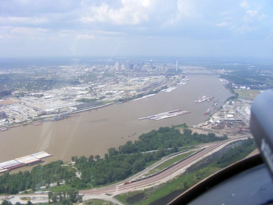
There are a large number of barges anchored near shore facilities for loading or unloading
as needed. You can see railroad yards are here to move freight from the river
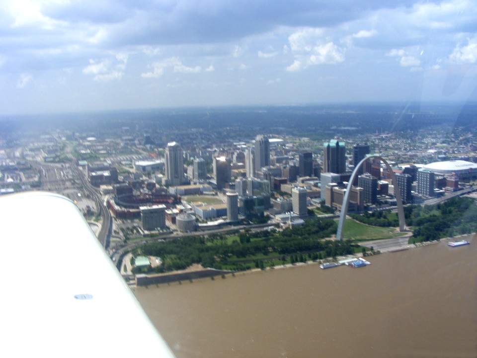
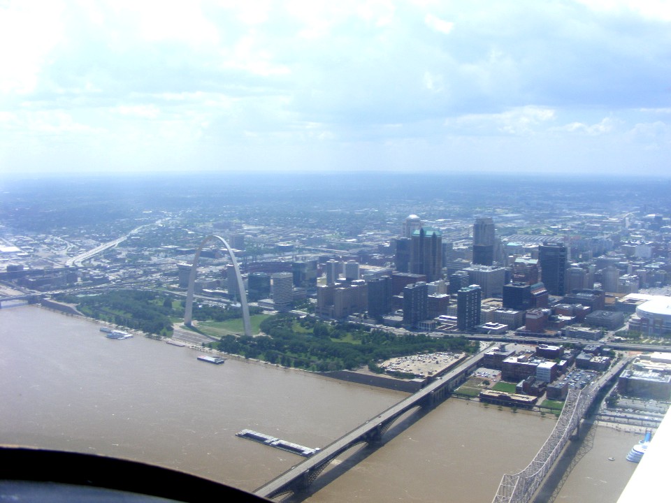
overland. The stainless steel Gateway Arch is in the distance viewed from its
southern edge appearing as a monolith like the Washington Monument in our nation's
capital.
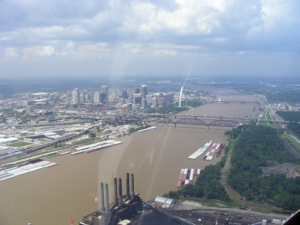
As we near the railroad and highway bridges across the river near downtown
Saint Louis, the parabolic shape of the Arch is slowly revealed. The railroad at the
right side of the photo is one-half mile from the arch. I have checked the distance
on a digital map before this flight. Edward is flying the airplane at this time and
will remain east of the railroad at 1,400 MSL.
A museum is located underground below the Arch. It is all about the
westward expansion after the Louisiana Purchase added much territory to the USA. The
elevators to the top of the arch are reached via the museum.
The arch is 630 feet tall and 630 feet apart at the base. You can stack
the "Statue of Liberty" on top of herself and still have head room below the
Arch. The elevators run up and down both sides of the arch from the underground
boarding areas in the museum area. There is an observation deck at the top about the
size of a small bus. The Arch is well worth a stop when you are driving past this
area.
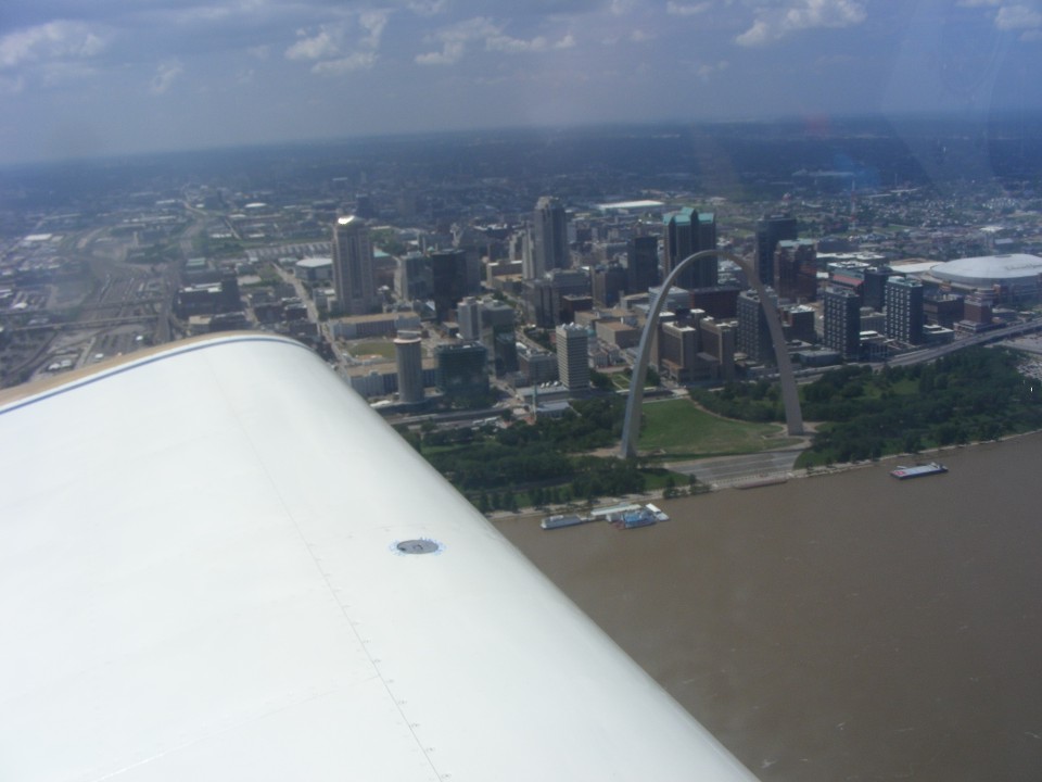
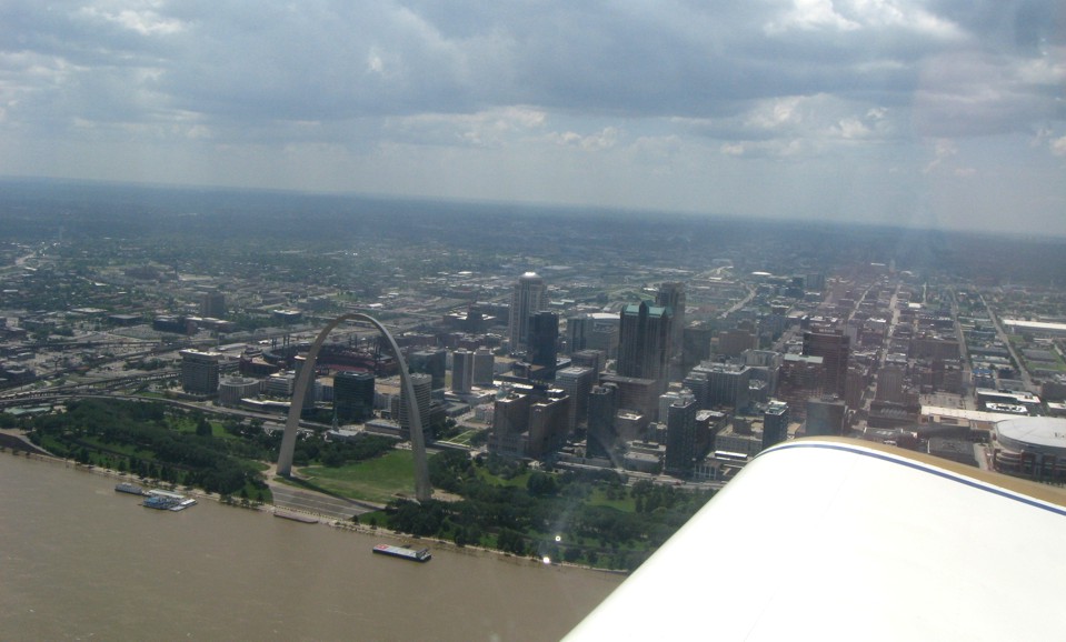
Once we passed the Arch, I took over flying the airplane and executed a
tear-drop turn north of the downtown area staying on the Illinois side of the river.
It was Edward's turn to take photos and use his video camera. Here is a
snapshot he took as I was completing the turn and rolling right for a "wings
level" pass down the East side of the river.
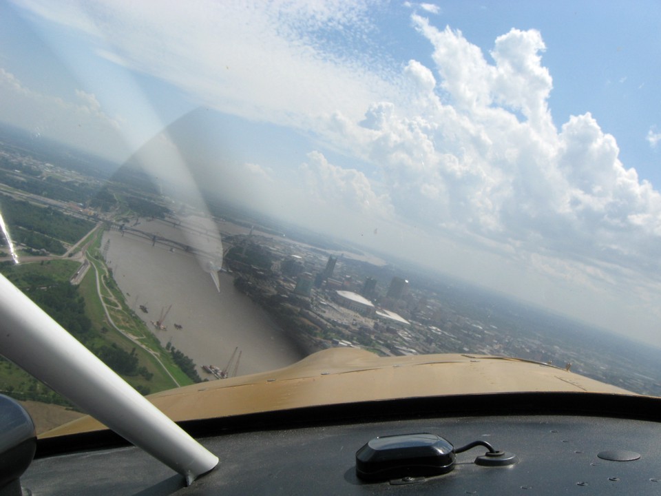
I got this snap shot from my side of the airplane.
The Arch is in a shadow from a cloud and not gleaming as in earlier photos.
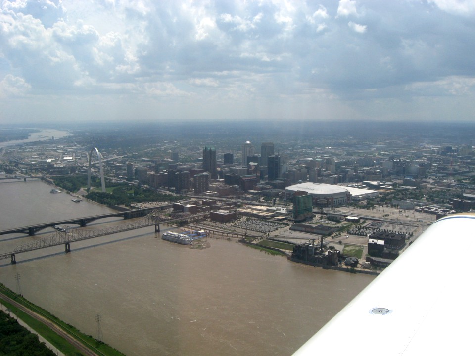
The Saint Louis Downtown Airport (KCPS) at Cahokia, Illinois is just across the
river and south of the Arch and all those bridges you have seen in the photos. We
have been monitoring the tower controller and her other air traffic coming and going from
here during our time inside their class-D controlled air space. Edward snapped this
photo as we made our southbound pass down the river. A Lear Jet is about one mile
behind us and cleared to land on the longer runway seen in this photo. I have the
Enterprise at full throttle to get out of his way to the approach. The video camera
on the panel is still being recorded on my digital camcorder by my seat.
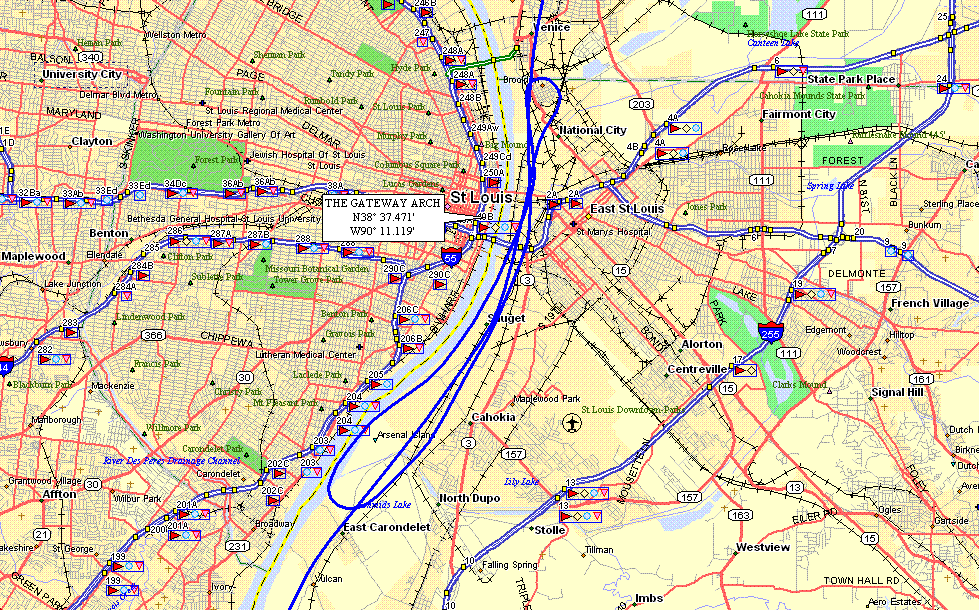
Here is the GPS ground track of the three passes in front of the Gateway Arch.
| OSH 10 - PAGE 6 | OSHKOSH 2010 MENU | MAIN MENU |